We have hiked Bald Ledge several times over the last few years, the last being on May 2nd of this year. On that day it was rainy and only five of us hiked to a summit that offered no view due to severe overcast. However, on that hike we did discover a new loop trail made possible by the recent opening of the new Bald Ledge Summit Trail with a new trailhead on the Colcord Pond Trail. By hiking down the new trail and following the Colcord Pond Road for a short distance, we were able to follow an old abandoned road now used by all terrain vehicles and snowmobiles, eventually reaching the abandoned Varney Road that brought us back to our vehicles at the Varney Road Trailhead. So, we decided to follow that route again as we hiked today. These trails are part of the Francis Small Heritage Trust network and are very well marked and maintained.
Five of us left the church and met seven others at the Varney Road Trailhead. Hiking today were Jeff Sturgis, Jacob Schor with his dogs Ruby and Piper, Greg Dean, Kathy Huchthausen, Sandy Bell, Jean Murch, Robin Marciello, Phil Johnson, Tom Dugas, Steve Kelly, Ginny Haase and Amy Haase. It was a cool day starting out in the low 40’s, but the sun was brilliant and we quickly warmed up and shed our outer layers after hitting the trail at 9:15 am. The Bald Ledge Preserve Trail up to the ledges from the Varney Road Trailhead is .7 miles, and we quickly reached the exposed ledges at 9:35 am.
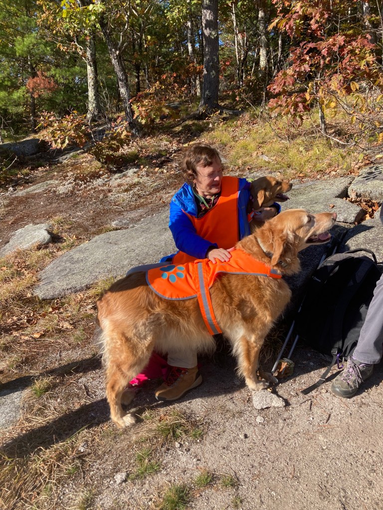
We basked in the sunlight and enjoyed our snacks and the view for about 15 minutes before crossing the ridge and descending the new Bald Ledge Summit Trail. This is a very nice trail that gradually descends to the Colcord Pond Road Trailhead over its picturesque one mile.


On the way down we met Denmark hikers Susan Sedita, Toni Carros and their artist friend LJ Thompson on their way up. They had opted to go clockwise on the loop we were going counter-clockwise on. After a brief visit and a picture, we continued down the trail reaching the trailhead at 10:30 am.
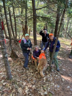
Even though it was still early in the morning, since we were over halfway though our hike, we decided to hunker down and have our lunch break. While we were eating, Toni returned from the summit long enough to be included in our trailhead picture.

After 20 minutes of rest and lunch, we started up the road on the last leg our hike. We shortly turned off the road onto the abandoned road that is used as an all terrain and snowmobile trail. This rough section consisted of a very rocky road that had been obviously washed out and degraded by motorized traffic over the years.

This section rose gradually over the next half mile. There were several abandoned roads/snowmobile trails that intersected the trail on the right, including one that goes to Devils Den, another Francis Small Heritage Trust property. At the crest of the trail, we reached the junction on the left of the upper part of the abandoned Varney Road. The sign promised that the trailhead where we parked was only .3 miles down the trail. This trail actually gently rose in elevation for about .2 of a mile before descending back to our vehicles in the parking area. We reached the parking lot at 11:35 am while discussing variations of this hike that we could take in the future. The All Trails app had our total mileage for the loop at 2.88 miles. As the temperature rose to the high 50’s, low 60’s, we left the parking lot after a very nice fall hike.
General description of this hike and map is on the hike announcement page for Bald Ledges posted last week. https://denmarkmountainhikers.com/2025/10/14/bald-ledge-overlook-oct-17-2025/
Next Hike – October 24
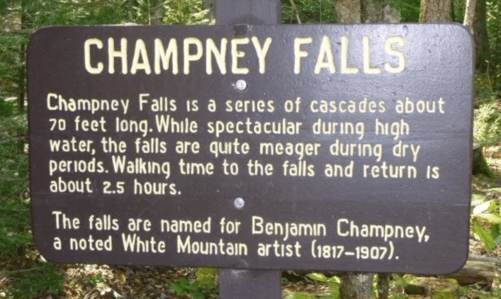
Champney Falls
October 24- Easy – Champney Falls (2,100 ft), Albany, NH – 3.1 mi RT, 682 ft elevation gain. RT hiking 1 ½ hours. RT driving 2.0 hours.
Meet at the Denmark church at 8:30 a.m – Directions to the trailhead: Take the Kancamagus Highway 11.5 miles west from Conway to the Champney Falls/Chocorua Trailhead parking area on the south (left) side of the road. This is a WMNF parking area and a daily fee per car is required, either payable at the site or parking passes are available at the Saco River Ranger Station at the intersection of Route 16 and the Kanc at Conway.

Leave a comment