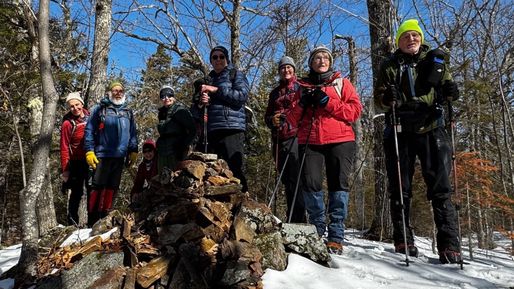
The Denmark Mountain Hikers climbed Tin Mountain in Jackson, New Hampshire on Friday, March 27, 2026.
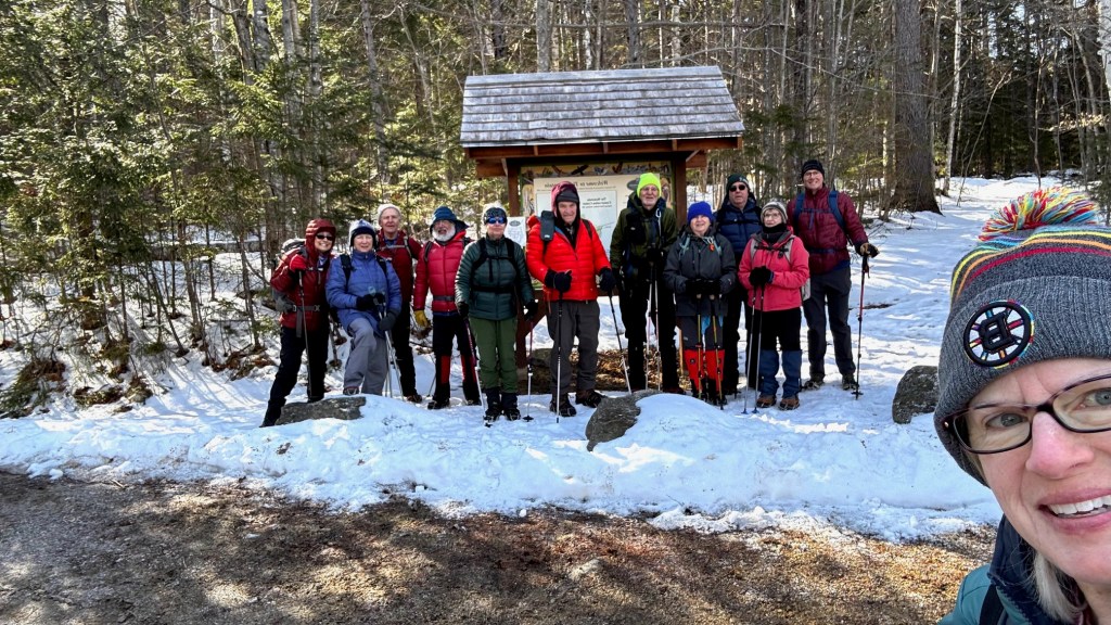
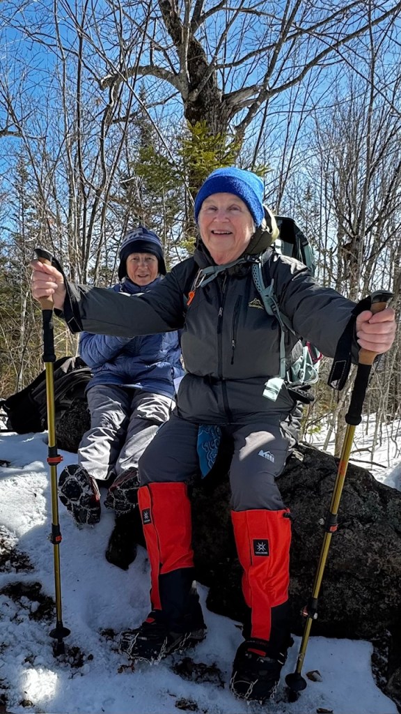
Hiking today were Greg Moulton, Jacob Schor, Kathy Huchthausen, Jean Murch, Robin Marciello, Jim Wilson, Chuck Donovan, Dale Nelson, Laura Sullivan, David Atchason, Polly Lombardi and Sandy Bell.
As we assembled in the trailhead parking lot, temperatures were around 30, but felt significantly colder probably due to the wind, under cloudy skies. Once we got on the trail (working our way steadily uphill), sheltered by the trees, it was more comfortable. During the hike, the clouds dissipated and by the end it was sunny with blue skies.
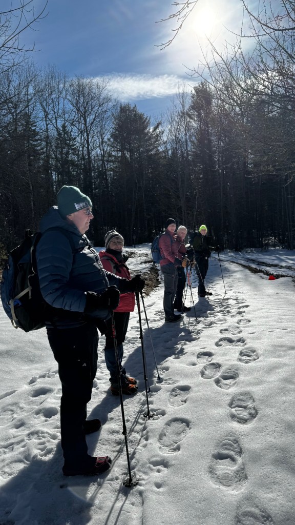
We started on the trail at 9:40 AM. Trail conditions were a combination of packed snow, ice and occasional bare ground. We all wore microspikes, which worked fine. Our route was a lopsided “lollipop”, starting out and back on Rockwell Trail, with a clockwise loop over the summit.
About 15 minutes in, we came to the old tin mine after which the mountain is named. It is apparently the oldest tin mine in the country. Here, it took the form of a small cave or tunnel. Inside was a beautiful array of icicles, in the shape of stalactites or stalagmites.
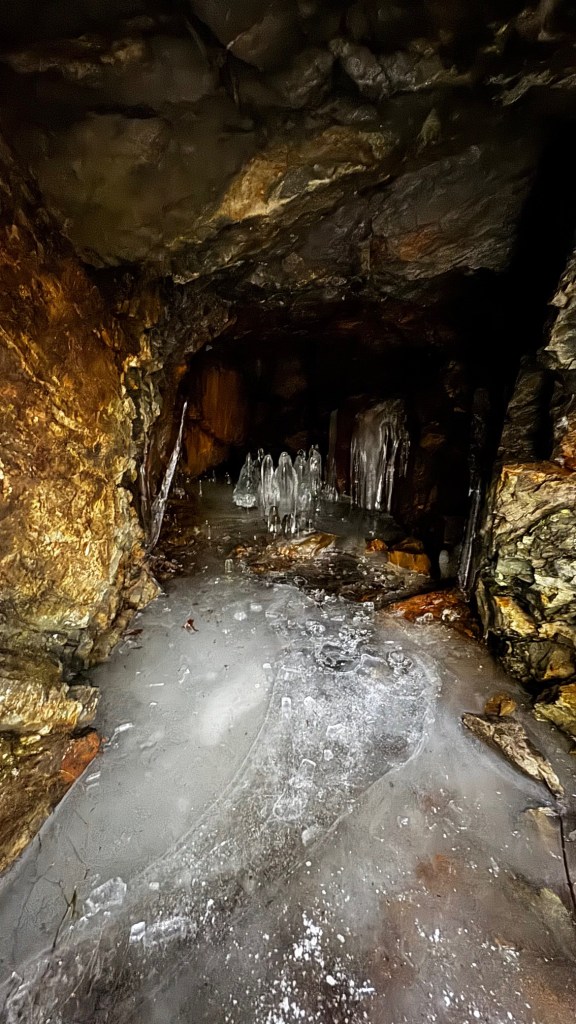
Which is which? Greg took the opportunity to haul out an old mnemonic: StalaCites hang from the Ceiling, while stalaGmites grow up from the Ground!!
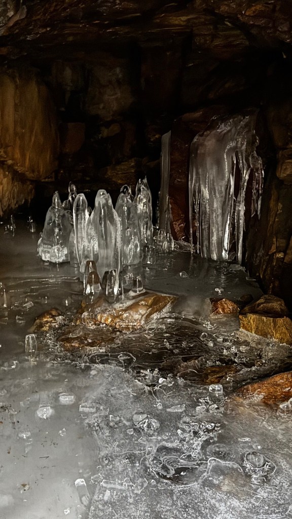
Several brave souls ventured inside, while most of us admired the ice formations from outside the entrance.
Back on the trail, we soon came to a spur trail, with a sign that said “Pit”. Who could resist? It turned out to be a big hole in the ground, but still an interesting reminder of the mining history in the area.
As we approached the summit, there was a steep stretch, with a few tricky spots due to ice and snow. We navigated carefully and arrived at the summit at 10:50 AM. The summit is marked with a large cairn and is wooded, with some partial views through the bare trees. A little past the summit, there is an open ledge facing south and west, with beautiful views of Attitash, the Moats, Thorn Mountain and more.
It was sheltered from the wind and exposed to the sun, so it was a good spot to hang out, eat snacks and admire the view.
After 25 minutes, we headed down, continuing the loop down the other side of the mountain. There were some steep spots, but again we navigated carefully and successfully. Eventually we came out on the “Old Town Road to Dundee”. We discussed options to extend the hike on other trails, but we decided we had had enough fun for one day, and headed back to the trailhead. We arrived at our cars at 12:30 PM. Greg’s GPS showed a distance of 2.7 miles in 2 hours 50 minutes, with 659 ft. elevation gain (seemed like more!).
We last made this trip a little over a year ago in January 2025. At the time Allen Crabtree summarized the history of the area for us in his hike report:
“Tin Mountain is located at the Jackson Field Station of the Tin Mountain Conservation Center on a 228 acres parcel of conservation land. In addition to the old tin mine, there are several old stone cellar holds and the old Jackson-to-Dundee Town Road, along with an extensive hiking and snowshoe trail network assessing 17 acres of fields, 211 acres of forest and four ponds. The Jackson Field Setation was built in 1981 and is used for programs and summer camp.
“Tin was discovered on the side of the mountain in 1840 and an adit and several pits remain from this period, as well as a tunnel extending back into the mountain. The tunnel is big enough to stand up in and open, and several of our group went inside to check it out. There were interesting ice stalagmites sprouting from the tunnel floor. Gordon took a picture of a huge cave spider egg sack hanging from the roof of the tunnel.
“In 1840 Dr. Charles T Jackson, NH State geologist, discovered a tiny vein of tin. This was the first tin found in the United States. Returning in 1841 with three geologists they found three more veins. In 1844 he said, ‘that although veins in Europe were wider, there are none where the ore is richer than that found in Jackson.’
In 1843, a year’s work using hand drills and black powder to open a horizontal shaft yielded only 11.5 ounces of processed metal.
In 1860 the Jackson Tin Company was formed and 67,000 shares were issued at $5/share.
[note: The company issued 67,000 shares at $5.00 each, raising a total of $335,000 in capital. The company sank two shafts into the mountain—one 25 feet deep and another 40 feet deep—along with a 90-foot adit (horizontal tunnel). The company sank 2 shafts and intermittently worked the mine until 1865. Expenditures reached $4,361.69, but no record of revenues or profits has been found. It is not known what happened to the remainder of the $300,000 raised in capital.
Historically, such discrepancies in early American mining ventures suggest that the majority of the “capital raised” was either never actually collected from subscribers (unpaid stock assessments), spent on lavish promoter salaries and marketing, or simply lost to mismanagement and the chaotic economic environment of the American Civil War.]
Tin extraction and use can be dated to the beginnings of the Bronze Age around 3000 BC, when it discovered that the addition of tin to copper increased its hardness and formed bronze, and the beginning of the bronze age is due to this discovery. Tin has been mined all over the world, currently in 9 countries but not the US, and is used in many products. Tin foil was once a common wrapping material for foods and drugs; replaced in the early 20th century by the use of aluminum foil, which is now commonly referred to as tin foil. Tin cans are actually made of steel or aluminum, although tin cans (tinned cans) do still contain a thin coating of tin to inhibit rust.
This week’s hike
April 3 — Mount Tire’m (1,073 ft), Waterford, ME – 1.75 mi RT,
From AllTrails: “This short and rewarding hike climbs to the ledge top of Mount Tire’m with excellent views to the southeast over Bear Pond, Keoka and Long Lakes, and Pleasant Mountain.”
We’ll take what Mary Lou calls the “new trail which starts at Grover Rd and then descend the ‘old’ trail to Plummer Rd.
However, and this is important: We will meet at the Mt Tire’m Trailhead (Daniel Brown Trail) on the Plummer Hill Rd just beyond the Congregational Church around 9 am. We will then ferry people up to the Grover Rd trailhead and start hiking from there. Jeff Sturgis will lead this hike. and he will go directly to Waterford to meet everyone, so those who meet at the church should organize themselves accordingly.

Leave a comment