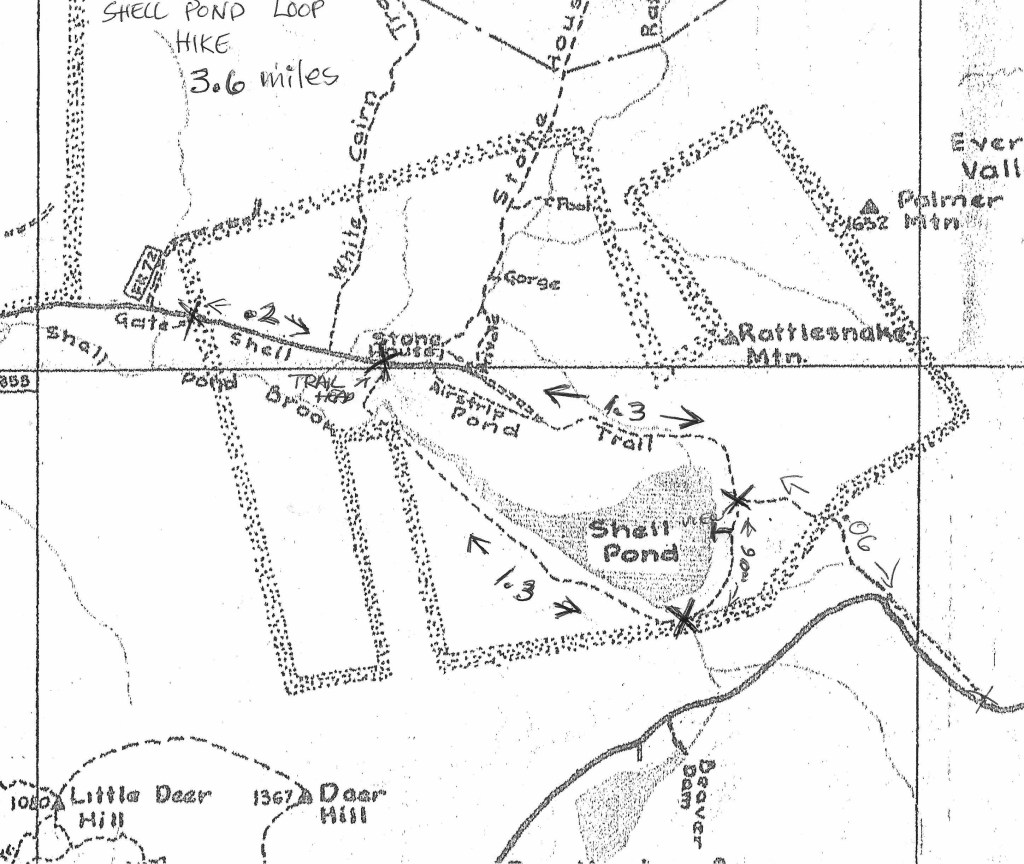
Shell Pond Loop Hike.
November 14, 2025
Driving Directions:
Travel north on Rte. 113 towards Evans Notch. The Stone House Road is the first marked town road after the parking lot for the Baldface Loop Trailhead. Turn right and follow the road to the end where there is a closed gate. The parking area is to your right.
The Hike: 3.6 miles from and to the gate. Elevation gain estimates vary from 171 to 300 feet.
Pass through the gate and follow the road for .2 miles to the Shell Pond Loop Trailhead on your right. The trail passes through a meadow and along the river, to a bridge crossing the Shell Pond Brook, and then swings left on a well-worn woods road. It traverses the slope above the south shore of Shell Pond. At 1.3 miles the trail turns left off the road and descends, meandering through the woods behind the east shore of the pond, and crossing several small brooks. At 1.7 miles a spur leads to a clearing and a view of Baldface across the pond. The main trail then bears right and meets the Shell Pond Trail at 1.9 mile. The trail turns left, broadens and runs alongside the base of Rattlesnake and Albany Mountains. The trail crosses a bridge over the Rattlesnake Brook and continues along the brook and through an orchard. Eventually the trail opens to an airfield with a view of the Stone House on the right. At 3.4 miles the trail returns to the Shell Pond Loop Trailhead after passing two trails leading to Blueberry Mountain on the right. The gate is straight ahead.