Singlepole Mountain is a 1,414-foot peak in Paris, Maine known for its somewhat steep trails, granite quarries, and panoramic views. There are two main routes: a steeper route up from Hall Pond and a gentler but longer route up Brett’s Hill trail. In the last year we’ve taken the Hall Pond Route twice in the last year. OUr first trip up was last July and our recent trip allowed us to experience the area in it’s late winter snow and ice pack.
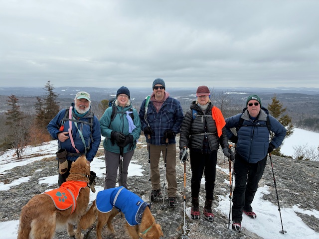
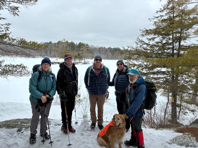
On March 6th, seven hikers met at the Halls Pond/Singlepole Mt trailhead on Halls Pond Rd in Paris, Maine under overcast skies with temperatures slightly below freezing. Hiking today were Jeff Sturgis, Jamie Doherty (Jeff’s nephew), Tina Estes, Laura Sullivan, Dale Nelson, Jane Gibbons and Jacob Schor with Piper and Ruby. The overnight cold weather had solidified the packed snow on the trail, so micro spikes were in order.
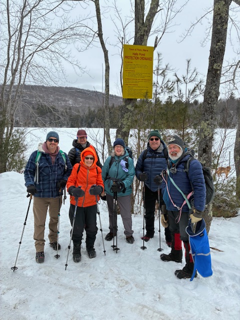
We took our trailhead picture at 9:35 am and then headed out on the trail.
The trail was level as we rounded the west side of Halls Pond, which is a town reservoir, and came to the trail junction with the Singlepole Mountain Trail after about .5 miles and 20 minutes on the trail. Here we parted company with Jane who decided to follow the trail around the pond back to her car while the rest of us started up the mountain. Our plan was to follow Jane’s path around the pond when we returned from the mountain trail spur.
The first quarter mile up the mountain trail had a gradual rise and was hard packed snow through an area that had been logged recently. The last part of the trail turned into a narrow, rocky and rooty path that rose steeply to the summit. The trail was combination of hard packed snow, ice and bare ground that climbed a ledge with several switchbacks.
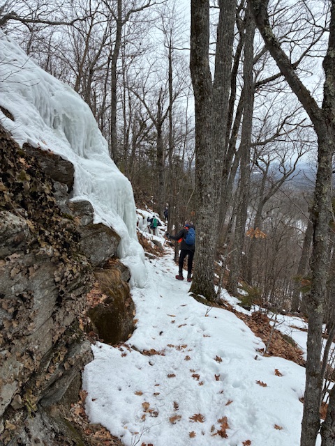
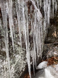
This slowed us down considerably. Before the final ascent, the narrow and ice covered trail traversed below long horizontal rock ledges with somewhat uncomfortable looking declines below.
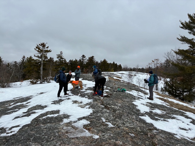
The microspikes continue to be an amazingly useful game changer for wihter hiking. I doubt many of, aside from the dogs, would have felt comfortable with walking where we did without these traction devices. Just below the summit the trail crossed an open, snow packed area that led to an open ledge devoid of snow.
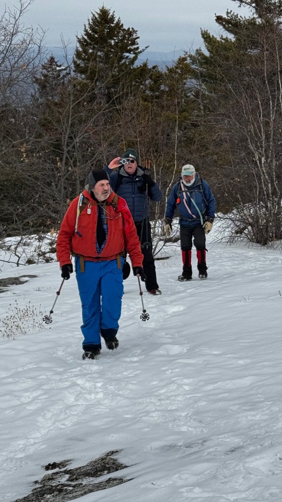
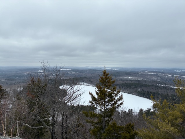
We reached this open ledge at 10:50 am and this was our destination as the true
summit, a little further along, has no view and is on posted private property. We were fortunate as there was no wind, so in spite of the cold temperature, it was quite comfortable for us to spend some time seated on the ledge and consuming our lunch. The overcast was quite high, so we had pretty much unlimited views of the landscape over the pond to the south and west of our location.
After a relatively pleasant 15 minutes or so, we started our descent. We moved quite slowly and carefully as the ice, snow and steepness and narrowness of the trail caused us to pick our steps judiciously.
After about 40 minutes, we reached the junction with the Halls Pond Trail. The rest of the hike was a pleasant .9 mile circumnavigation of the pond that returned us to our vehicles at around 12:25 pm after a hike of 2.6 miles with 534’ of elevation gain. Near the end of the hike we stopped briefly for a picture at a ledgy outcropping that, on sunny days, is a great lunch spot. We did this hike last July, and the experience this time in the winter was different, but still very satisfyinga
NOTE: Spring hike schedule
It is time to develop our hiking schedule for the months of April, May and June. Please email your suggestions for hikes to me at jeffreysturgis54@gmail,com, and we will publish a schedule at the end of this month.
Next Week: Amos Mtn. Lovell Maine March 13, 2026
Length: 3.1 mi Elevation gain 583ft Estimated hiking time out and back: 1.5–2hr
The Homestead trail offers a gentle hike to a picnic table, and apparently at some times in the year is hard pack gravel. Along the way there are great views of the surrounding mountains and Kezar Lake below. The true summit is wooded and does not offer any viewpoints. However there are lovely views along the route. Dale Nelson will lead this hike and we’ll post more details in the next few days.

Leave a comment