[Report submitted by Greg Moulton, although edited in spots by Jacob Schor]
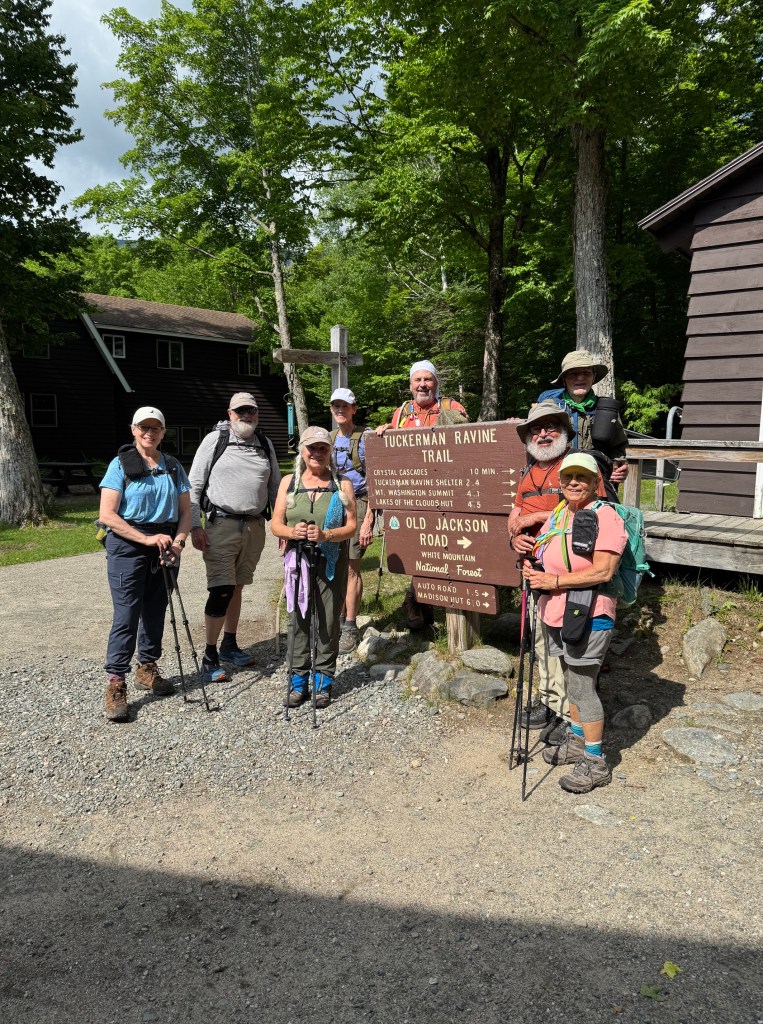
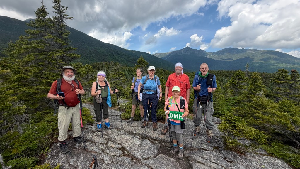
Eight Denmark Mountain Hikers clambered to Lows Bald Spot in Pinkham Notch, NH on Friday, June 12, 2026. Hiking were Greg Moulton, Jeff Sturgis, Jacob Schor, Gordon Farrell, Robin Marciello, Laura Sullivan, Janet Arens and Susan Sedita.
We were initially rather concerned about the weather, as the forecast called for a likelihood of showers, and a chance of thunderstorms. There was occasional rain as we drove to the trailhead, but once on the trail there was no rain and no thunder or lightning. There were even patches of blue sky. The main issues were heat, with temperatures in the 70s and 80s, and especially humidity. It was at least in the “uncomfortable” range and probably “oppressive”. This made the hike seem longer and harder than it should have been, but we persevered. Even the bugs were not as bad as expected. They were in the air, but seemingly slowed by the humidity that made the air too viscous to fly in. If we kept moving, the bugs had difficulaty keeping up. Even sitting on the summit, they made threatening noises, but didn’t really come after us.
[The combination of warmth, and high humidity appeared to have produced a rare condition. The rocks we clambered over that protruded underfoot were relatively cool compred to the air and it seems moisture condensed on them throughout the day so that they were wet all day long, making it look as if it had been raining but only on the stones. The ground looked relatively dry. This was something that Jacob, the son of a meteorologist, took special notice of but which the rest of the group found of little interest]
We started on the trail at 9:55 AM.
Starting behind the Pinkham Notch Visitor Center, we headed north on the Old Jackson Road trail. The trail was easy to follow and mostly moderate hiking. There was one fairly steep stretch near the start, to get our blood pumping. Most of the trail consisted of moderate ups and downs interspersed with level stretches.
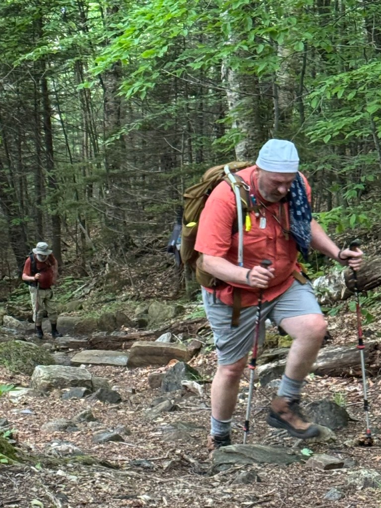
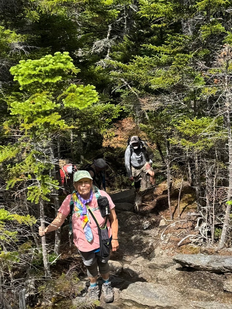
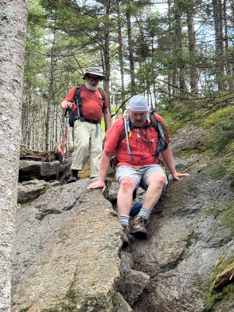
Toward the end of the Old Jackson Road segment, there were a couple short rock scrambles. Then we came to the Mt. Washington Auto Road, and crossed that successfully. On the other side, we resumed on the Madison Gulf Trail. After 0.2 miles, we came to the spur trail for Lows Bald Spot. This had some steep rock scrambles, which we navigated carefully without major mishap, demonstrating the power of engaging in such endeavora co-operatively. This means that Susan shouted out a warning prior to hurling her walking poles up over the ledge giving the other participants standing above her ample opportunity to duck out of range.
We reached the top at 12:00 noon.
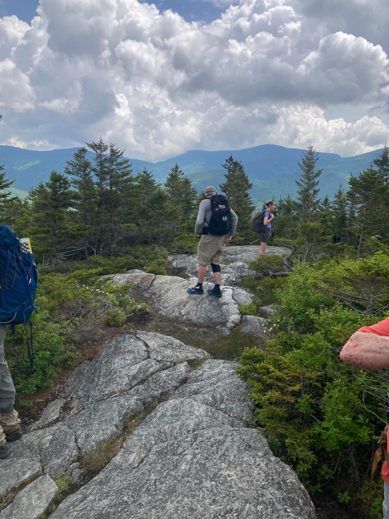
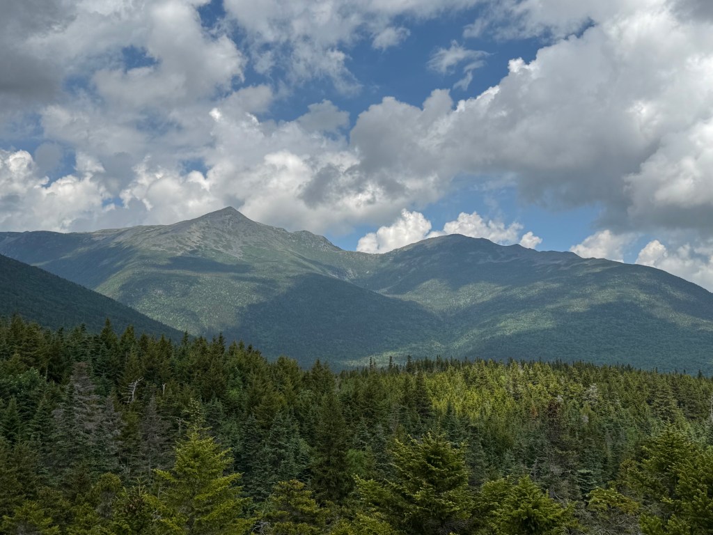
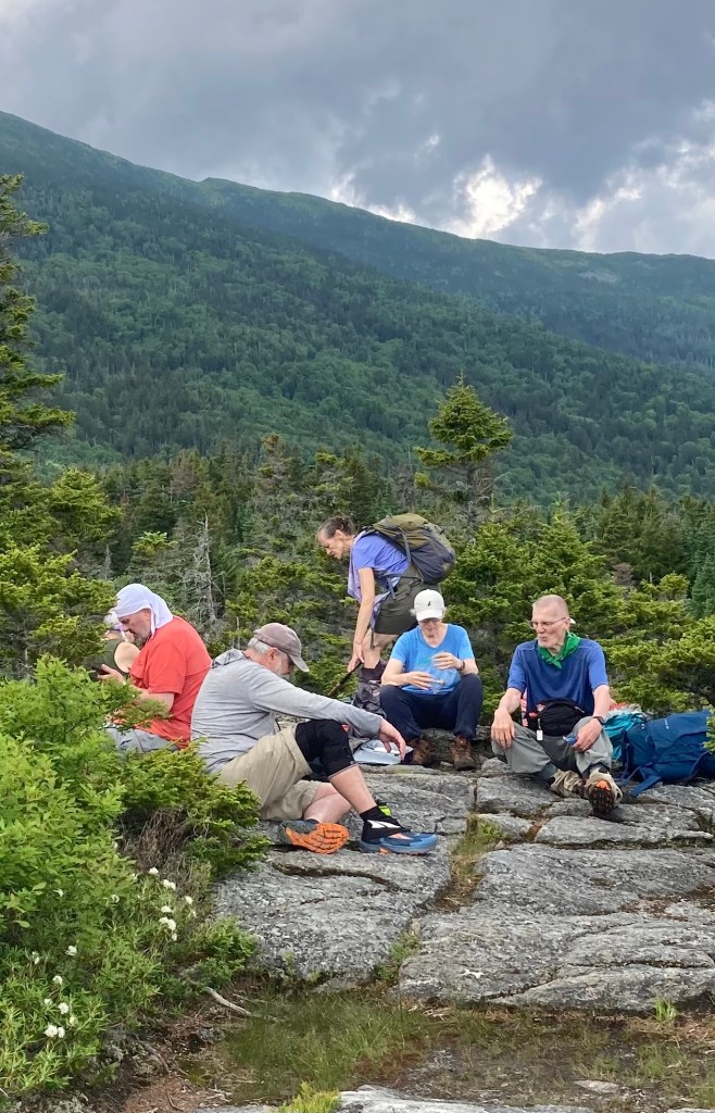
Lows Bald Spot is a rambling, ledgy knob. There are some trees scattered about, but it is mostly open with a near-panoramic view. Mt. Washington may have been hiding behind Nelson Crag, but we could see Adams, Madison, Wildcat, the Carter ridge, and many other peaks in the area. The sun even came out as we ate our lunch and admired the view.
After 30 minutes, we headed down. We carefully picked our way down the scrambly sections and retraced our steps back to the beginning, finishing at 2:10 PM.
We agreed that it was a great hike, though somewhat strenuous in the conditions. Did I mention it was hot and humid? Our total time on the trail was 4 hours, 15 minutes. All of us had trouble getting our AllTrails or GPS to work, but the book says the hike is 4.4 miles with 1050 feet elevation gain. [Some of us didn’t even try]
Early on the way up toward Lows, our trail intersected with The Appalachian Trail and Greg took a photo of what at first appeared to be a vandalised trail sign that he found himself fascinated with. And since we are going to include my part about the condensation on the rocks, we will include his description of the sign. Note how someone has added a S for south and a N for North. At this point these directions are not accurate. South is to the right and North to the left. We ourselves turned left at this sign and headed north toward the summit for a distance. We considered this sign alteration as some small minded act of vandalism as we walked past.
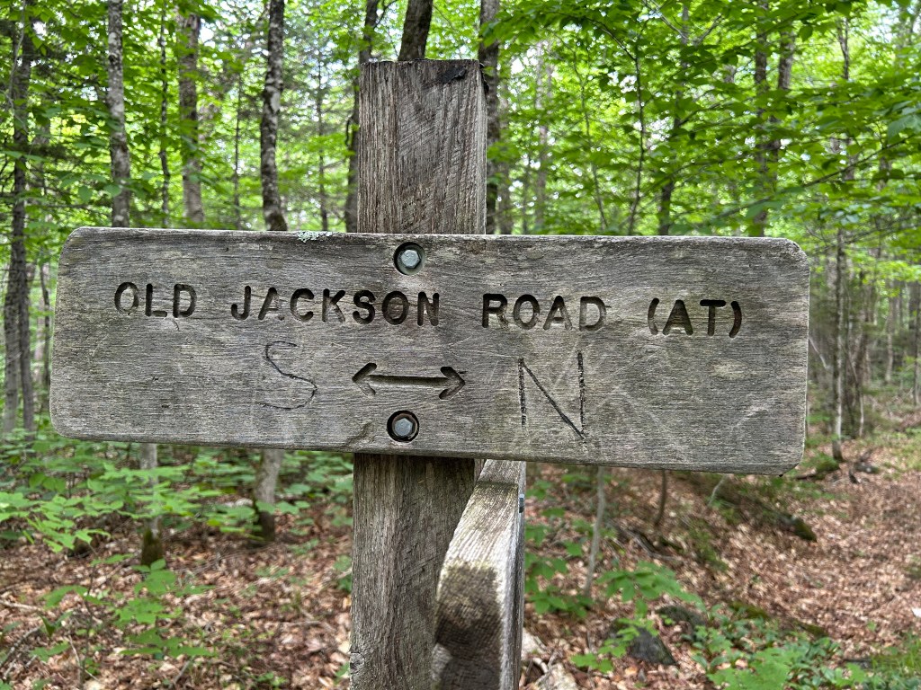
We knew for a fact that North, where we were heading, was clearly to the left, so we thought that whoever added those letters either had a poor sense of direction, or was trying to confuse us. However, eventually, after some discussion, light dawned on Marblehead! The trail, Old Jackson Road, is also part of the Appalachian Trail, and the letters are actually correct for Northbound and Southbound hikers on the AT. The reason: For a few miles, northbound hikers on that segment are actually going in a southerly direction. At Pinkham Notch, the AT crosses the road to Wildcat and soon resumes its northerly course. So we were wrong to cast aspersions on those who amended the sign in a helpful manner. It just goes to show, every day, and every hike, you have the opportunity tolearn something new! [and also that on very hot days, our attentions can become riveted on odd little observations in the hope to make sense of them but that other ight not find all that interesting.]
NEXT WEEK’S HIKE
June 19, 2026. Easy – Mount Tom (1,073 ft), Fryeburg, ME.4.2 mi RT with 573 ft elevation gain. RT hiking 2.5 hours. RT driving 1.25 hours.
Mount Tom in Fryeburg, Maine, is a 1,073-foot peak situated within the 995-acre Mount Tom Preserve. Managed by The Nature Conservancy, this protected area is highly regarded for its Saco River frontage, diverse floodplain ecosystems, and a moderately challenging hike that offers rewarding panoramic views
Below is a description of the hike that Allen wrote at some point in the not too distant past:
Easy – Mount Tom (1,073 ft), Fryeburg, ME. 2.0 mi RT with 573 ft elevation gain. RT hiking 1.5 hours. RT driving 1.25 hours.
Meet at the Denmark church at 8:30 am. This is a familiar hike to the ledges atop the mountain that looms over the Saco River east of Fryeburg. Our last hike here was in April 2024. We’ll climb via the old trail that starts at the Menotomy Cemetery and descend via the West Ridge Trail built by the Nature Conservancy, or the other way around depending on what the group wants to do when we get to the trailhead. We will need to spot cars at the West Ridge trailhead to shuttle hikers at the end of the hike. After the hike we’ll take a dip in the Saco River at the Route 302 Bridge – we’ve done this before and the water should be fine.
Note: we haven’t determined which route we will hike yet so watch for an update as to which trailhead to meet at.
Directions to the old trailhead – Take US Route 302 East from Fryeburg and turn left onto Menotomy Road. Follow Menotomy Road for 2.3 miles to the Menotomy Road Cemetery on the right. Parking is along the side of the road at the Cemetery. The trail starts just north along Menotomy Road at a barn on the same side of the road, and initially goes near several homes. Please stay on the trail and respect the private owners who have allowed hikers to go through their back yards.
Directions to the Nature Conservancy trailhead – Take US Route 302 East from Fryeburg and turn left onto Menotomy Road. Follow Menotomy Road for 0.9 miles to the Mount Tom Trailhead on the right. There is a large trailhead parking lot (not plowed out in winter). The Nature Conservancy Preserve is open for day use only, and they ask that group size be limited to 12. Please carry out all of your trash. Dogs and domesticated animals are not allowed on the preserve. No fires, fireworks or smoking. ATV’s, bikes, and vehicles are prohibited.

Leave a comment