Church Pond Hike Report
September 11, 2026
By Jeff Sturgis
It was sunny and in the 50’s as eleven Denmark Mountain Hikers gathered at the Church Pond trailhead in the Passaconaway Campground off the Kancamagus Highway.
The trail is out and back with a length of 1.1 to 1.5 miles, depending on which website you consult. It used to be a loop trail. However, the return loop was decommissioned many years ago. In spite of this fact, several websites still advertise it as a loop. The trail is essentially flat with a modest elevation gain of 50’ at the mound that is at the terminus of the trail beside the pond.
We have hiked this trail five times in the last ten years. Hiking today were Jeff Sturgis, Paul Waterhouse, Jacob Schor, Pete Sickles, Kathy Huchthausen, Sandi Bell, Dale Nelson, Kitty Nelson, Phil Johnson, Diane Campos and Beverly Reid.
After our trailhead photo, we hit the trail at 9:50 AM. The trail starts with a water crossing of the Swift River which entails removing your boots for water shoes.
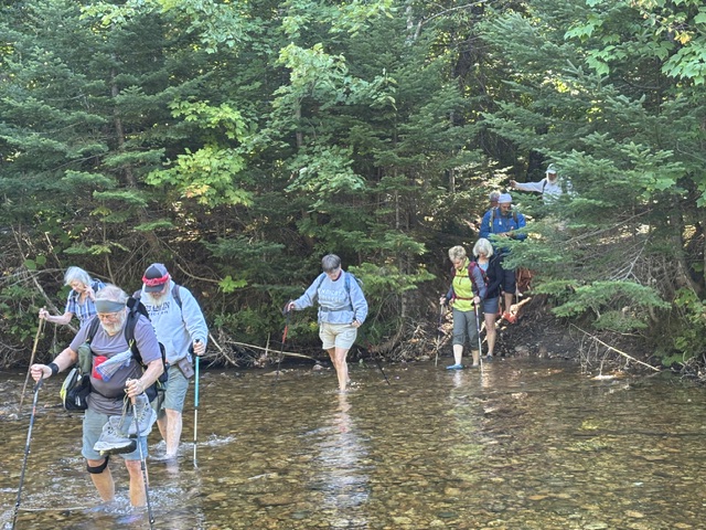
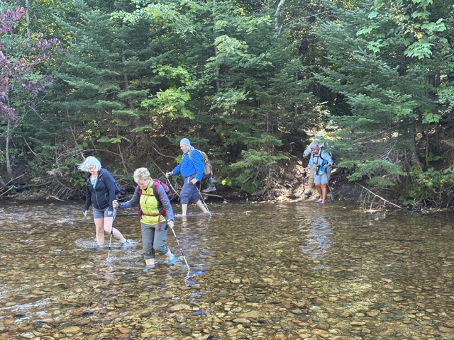
This is shortly followed by another water crossing that is shallower and can usually be navigated in waterproof boots on top of the gravel. However, when we encountered the second stream, it presented as a fairly deep pool. The reason was apparent as beavers had constructed a relatively new dam at this spot. However, after a little scouting around, we found a spot downstream that was shallow enough with gravel and bunched branches that we were able to cross without again donning our water shoes.
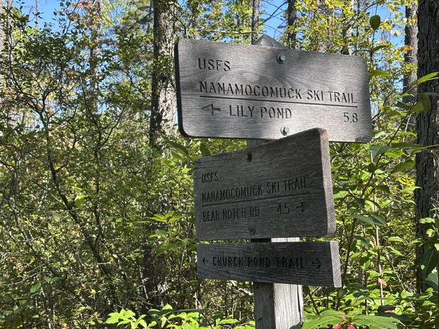
After exiting the delta area near the streams, the trail becomes a pleasant walk in the forest over a wide trail that may have been an old woods road. We passed a cross country ski trail that came in from the right and a little further on, the junction that marks continuation of that trail to the left that goes to Lily Pond, 5.8 miles away.
We soon entered the bog that bordering the pond that is traversed via an extensive boardwalk system that extends for about .4 miles and leads up to the short hill at the top of which was our destination.
Our stopping point is a clearing atop a small knoll in a wonderful large pine grove that overlooks the pond with views through the trees to several mountains that border the area. After some discussion a consensus was reached that the trees were red pines. While we were out of the wind for most of the hike, the elevation of our little spot in the grove exposed us to an intermittent stiff breeze that had some of us donning our jackets.
On past hikes, some of our hikers had gone swimming in the warm, shallow waters of the pond. However, their experience with the plethora of leeches that make the pond their home has ended any desires for that activity. We arrived at the grove at 10:45 AM in just under an hour of moderately paced hiking. Given the chill there, any discussion of swimming was dropped. We enjoyed about 20 minutes for snacks and socializing, and all agreed to head back at 11:10 AM as the breeze had picked up.
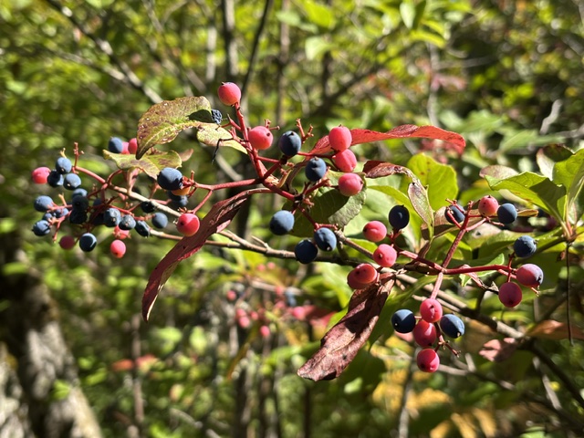
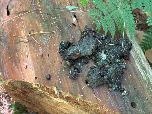
The hike back was uneventful, but we enjoyed the various berries on the bushes and various species of mushrooms. We encountered many signs of bears as we spotted their tracks and a few piles of scat left by the trail. The multitude of berries in the bog were an obvious attraction. We also spotted a few moose tracks in the mud underfoot. We redonned our water shoes, recrossed the Swift River and returned to our vehicles exactly at noon after a nice early fall hike under very pleasant conditions.
Next Week’s Hike: Sept 18, 2026 Bald Ledges
Bald Ledge – Sept 18, 2026
Easy – Bald Ledge Preserve Trail (1,187 ft), Porter, ME – 1.4 mi RT, 400 ft elevation gain. RT hiking 1 hour. RT driving 2 hours.
Directions to the Danforth Lane Trailhead coming from the north: From Brownfield take Main Street/Brownfield Road/Eaton Road for 5.5 miles from the junction with Route 5/113 towards NH, turn south (left) on Porter Road for 2.2 miles. Porter Road becomes Kennard Hill Road – follow it for 1.6 miles to Danforth lane. The Francis Small Heritage Trust trailhead is ¼ mile off Danforth Lane where there is a parking at the trailhead.
Five of us hiked Bald Ledge in May 2024 in the rain. On that hike we discovered a new trail that descends the other side of the ledge and goes to a new trailhead on the Colcord Pond Road. After summiting. We continued and descended the new trail. Jacob, Dale and Jeff continued on some old discontinued roads, not all together certain where they were going but managed to circumnavigate the ledge and, after 2.7 miles, found themselves again at the Danforth Lane Trailhead. So, we have two options next week: those who wish to can choose to go to the summit and return on the Baldhead Preserve Trail for an easy out and in hike of 1.4 miles or, those who wish for a longer hike can continue down the new Bald Ledge Summit Trail and hike a loop around the ledge for a hike of 2.7 miles.

Leave a comment