Gordon, who will lead this week’s hike up Potash Mtn, has asked me to post a note reminding everyone that this is a busy weekend up his way. Between the Fair in Fryeburg and the leaf peepers driving on the Kancamagus Highway, there may be more people in the area than usual. Our feeling is that getting through Fryburg and perhaps Conway might be a bit congested but that parking at the trailhead should still be fine, at least first thing in the morning. Thhe trailhead parking lot is pretty much directly across the road from the Passaconway Campground so if the trailhead lot is filled just park at the campground.
No one has mentioned to me whether this lot is a Forest Service Fee Area but let’s assume it is and be sure to bring and display your passes.
This week’s Hike: Potash Mtn.
October 9 – Moderate – Mount Potash (2,700 ft.), Kancamagus Hwy, NH. 3.5 mi RT, 1,400 ft. elevation gain. RT hiking 2.5 hours. RT driving 2.5 hours. (HL – Gordon)
Mount Potash (also known as Potash Mountain) is a 2,680-foot peak in the White Mountain National Forest of New Hampshire, offering 360-degree summit views as part of the popular 52 With a View hiking list.
- Location: Off the Kancamagus Highway (Route 112), across from the Passaconaway Campground near Wonalancet/Conway, New Hampshire.
- Trail Length: ~4.0 to 4.2 miles round-trip (out-and-back).
- Elevation Gain: 1,387 to 1,400 feet.
- Estimated Time: 2.5 to 3 hours.
- Difficulty: Moderate, featuring a gentle start that turns steep with rocky and root-heavy terrain near the top.
Trail Map https://www.trailfinder.info/trails/trail/mount-potash
Trailhead directions:
From Conway: Follow the Kancamagus Scenic Byway (NH-112) west for 14.2 miles, and turn left for the Downes Brook Trailhead, across from the Passaconaway Campground.
- Trailhead Parking: Located at the end of a very short gravel access road on the south side of the Kancamagus Highway (NH-112) in Albany, NH.
- The Campground: The trailhead parking lot sits directly across the highway from the Passaconaway Campground and Passaconaway Historic Site. [
- Starting the Hike: We will begin walking on the Downes Brook Trail from the parking lot. After about 150 feet, pass the UNH trail split, stay right, and follow Downes Brook Trail for about 0.4 miles before veering right onto the official Mount Potash Trail.
The GPS coordinates for the Downes Brook Trailhead parking area (which serves as the main trailhead for the Mount Potash Trail, UNH Trail, and Downes Brook Trail) are:
- Decimal Degrees (DD): 43.994200, -71.369317
- Degrees, Minutes, Seconds (DMS): 43°59’39.1″N 71°22’09.5″W
- GPS Coordinates Format: N43° 59.652, W071° 22.159
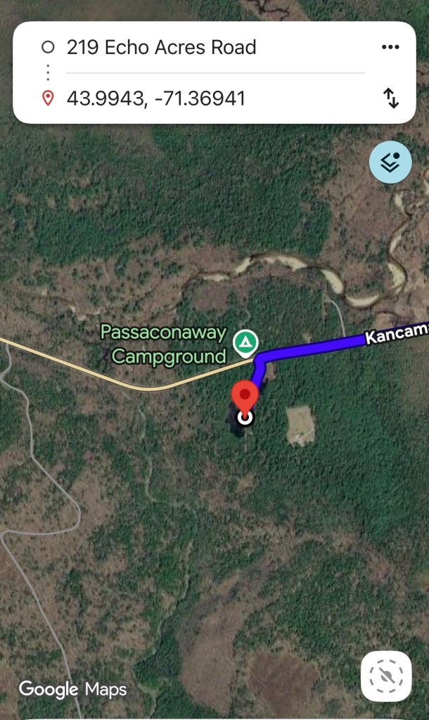
Here you can see and aerial Google view of the parking lot for the trailhead and the campground across the street.
[thank you Gordon]
While on the Subject of Potash:
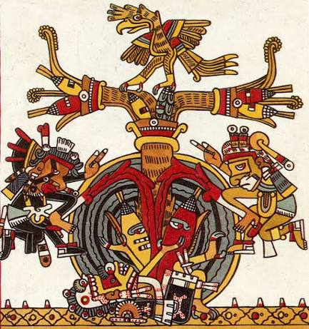
This Potash business left me ruminating about that chemical process called nixtamalization in which dried corn is soaked in an alkaline solution, traditionally slaked lime (calcium hydroxide), in order to soften the kernels and boosts their nutritional content.
The biggest nutritional improvement is that it releases the niacin and other essential amino acids in the corn. Trying to live on large amounts of corn that hasn’t been treated with alkaline agents can lead to a Vitamin B 3 deficiency and a nasty disease called pellagra.
This nixtamalization thing is typically thought of as a Mesoamerican practice, something done in Mexico when making corn tortillas and the masa made with corn and lime to make them. The word nixtamalization, (I’m thinking the first part at least) comes from the Nahuatl (Aztec) Language.
But this was also done in Maine
However, the chemical process—cooking and steeping dried corn in a highly alkaline solution—was widely practiced by the Wabanaki Nations (including the Penobscot, Passamaquoddy, Maliseet, and Mi’kmaq) in Maine and neighboring Abenaki groups in Vermont and Canada. Because limestone deposits (the source of Mesoamerican slaked lime) are not accessible in the forested Northeast, Indigenous peoples in our region adapted the process by using hardwood ash from their cooking fires to create an alkaline lye solution.
Hardwoods that are abundant in Maine, such as maple, beech, and birch, produce ash high in potassium hydroxide (potash). When mixed with water and boiled, this created the strong alkaline bath needed to break down the tough outer hull of northern flint corn.
Rather than grinding the corn into a fine, cohesive dough (masa) for tortillas as was done in Mesoamerica, the Northern Algonquin and Wabanaki used the process to make hulled corn (similar to hominy or posole). The puffed, softened corn kernels were thoroughly rinsed to remove the bitter ash and then boiled whole into dense, highly nutritious corn soups, stews, and porridges.
Without this wood ash treatment, a diet heavily reliant on stored corn would have led to vitamin deficiencies and pellagra.
It may be that corn alone, without this additional alkaline processing, was not capable of sustaining a society that relied on it as a primary caloric source. You might say that generations of Americans have grown up on Corn Flakes, but look at the label; they’ve been enriched with vitamins to compensate.
More information: https://www.pressherald.com/2017/02/12/green-plate-special-farmers-cooks-and-food-pros-learn-how-to-make-masa-from-maine-grown-flint-corn/

Leave a comment